(VOVWORLD) - In the cause of national reunification, the Truong Son route became an eternal symbol of the Vietnamese people’s unwavering will to fight and win. Along this legendary road, soldiers, youth volunteers, and logistics workers braved dangers to clear the way for supplies from the northern rear to the southern battlefield. This vital transport artery and bridge linking the rear to the frontline became a powerful symbol of the Vietnamese people’s desire for independence, freedom, and national unity.
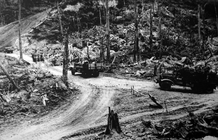 Trucks transport goods to the Southern battlefield. (File photo) Trucks transport goods to the Southern battlefield. (File photo) |
The Truong Son route was officially established on May 19, 1959, when the soldiers of Group 559, a special military unit, began the long march southward. In the beginning, the Truong Son route was merely a muddy footpath winding through rugged, steep, forested mountains. The main transport methods were backpacks, shoulder poles, and bicycles.
Major General Hoang Anh Tuan, former Deputy Director of the Political Department of the General Department of Technology at the Ministry of National Defense, said: “When it was first established in 1959, the force had only 500 officers and soldiers, most of them from the South. The route had actually been used during the resistance war against the French, which is why it was called a “trail.” Armed Forces Hero Nguyen Viet Sinh, a liaison soldier at the time, is said to have traveled a total distance along this route equivalent to circling the Earth.”
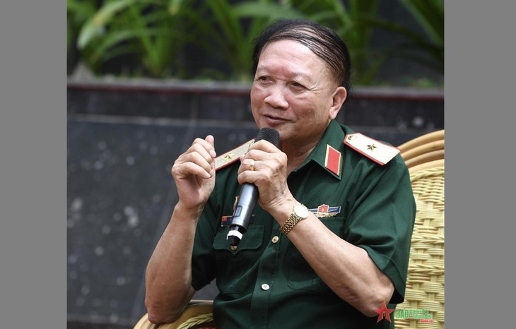 Major General Hoang Anh Tuan, former Deputy Director of the Political Department of the General Department of Technology at the Ministry of National Defense (photo: qdnd.vn) Major General Hoang Anh Tuan, former Deputy Director of the Political Department of the General Department of Technology at the Ministry of National Defense (photo: qdnd.vn) |
With determination and courage, the Vietnamese military and people used rudimentary tools to expand many sections of the route to accommodate motor vehicles. Major General Vo So, former Deputy Commander of Corps 12, said: “In 1968, Regiment 98 cleared 500 kilometers of road from Muong Lo in Thanh Hoa province to the border junction with Champasack province in Laos. The trail passed through high mountains and crossed many rivers and streams. In the beginning, with little experience, we – the volunteer forces, army engineers, and soldiers – used rudimentary tools to open the road. Later on, we had bulldozers, excavators, and some explosives to clear the route.”
Major General Vo So said that, of the 10 million tons of bombs dropped on northern Vietnam, more than 4 million fell on the Truong Son route. On average, that’s 5 to 10 bombs for every meter of road.
Engineering units worked day and night to clear bombs and mines, build more than 3,000 bridges, and fill in thousands of bomb craters to ensure traffic was never disrupted for very long. From 1959 to 1975, the once-secret trail through the forest became 17,000 kilometers of trails, criss-crossing 20 provinces and spanning 3 countries – Vietnam, Laos, and Cambodia. It was the main itinerary connecting strategic areas, military zones, and fuel pipelines. Millions of tons of weapons, food, and medicine were transported over the route, and more than 2 million troops marched to and from the battlefield.
Major General Luong Si Nhung, former Commander of Corps 12, recalled: “The engineers opened the roads with the motto ‘blood might be shed, but the route must never be blocked’. The enemy tried every means to obstruct us. Key points such as ferries, fords, and mountain passes were bombed day and night to block the path to the south. But our soldiers were determined. ‘If one route was blocked, we’d open another. If one section was destroyed, we’d create an alternative.’ The Truong Son route had five vertical axes and 21 horizontal axes to ensure a smooth supply to the South.”
Fifty years after the liberation of the South, the heavily-bombarded Truong Son route has become a symbol of development and unity. Formerly ravaged strongholds and command bases like Ca Roong, Ta Le ford, and Phu La Nhich pass are now “red addresses” for teaching younger generations about patriotism.
In 2011, the Vietnam Record Association recognized the Truong Son route as a one-of-a-kind military road, the longest of its kind, constructed in some of the harshest terrain, its highest point climbing to 2,180 meters. The mountain range provided the lowest temperatures, the most rainfall, and the least evaporation in the history of Vietnamese military transportation.
Major General Luong Si Nhung said: “The legendary Truong Son route will forever be remembered in our nation’s history. It connected socialist North Vietnam to the southern front. Without the Truong Son forces, the South would not have had the resources to fight and win.”
The Truong Son route, now a historical symbol, is also still a vital transport artery. It has become a national highway that links the north and the south and is unlocking the potential of the localities it passes through.